
04 Jul Discovering Nusa Penida
Discovering Nusa Penida
Dirt roads and near death experiences

We heard the crash before we saw it.
My friend Sam continued steering our scooter around the U-shaped valley to where a bend in the road turned uphill to a small village. There, beneath the road, a large indistinguishable yellow object was slowly sinking into a canopy of green leaves.
It was an Indonesian truck, laden with construction materials, that had come off the road beneath the village and plummeted down the steep bank into the undergrowth. We found it upside down, ten meters below the road, obscured by a fog of cement dust.
Sam stopped our scooter and along with men from the village climbed down the bank,
disappearing into the brush. I watched and waited with a growing crowd of women and children from the roadside until, together, the men lifted the truck, pulled the unconscious driver free and reappeared, carrying him to a waiting van to be taken to the hospital.
We got back on our scooter and continued on into the hills, stunned, shaken, but unsurprised. To visit Nusa Penida is to watch an endless tango between beauty and danger. Frightening as the crash was, it had taken us less than an hour to realize that underestimating the hazards of the island was not a mistake we wanted to make.
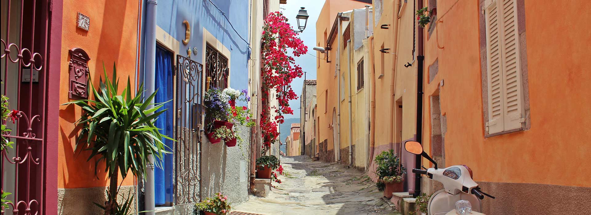
Potential visitors should be warned that, while far from a tropical hell-hole, Nusa Penida is not an exotic haven where beauty thrives free from danger. Instead, its charm lies in how, unlike mainland Bali, it remains relatively untouched by tourism’s footprint.
One of many positive side-effects of this is the absolute absence of the infamous traffic of mainland Bali. This is because on “the Nusa islands”, as the chain of Nusa Penida, Nusa Ceningan and Nusa Lembongan are collectively called, scooters are the main form of transport. There are few cars here and you’ll even see parents scooting around, sans helmet, balancing children barely old enough to walk on their laps..
If you’ve never ridden a scooter before and want to avoid being one of the growing number of tourists who incur easily avoidable injuries on scooters or motorbikes in Bali each year, there are two alternatives to hiring your own. You can pay a local tout to take you somewhere on the back of their bike, or book a guided minivan tour of the island.
We now saw how, on this island, danger and beauty reflect one another everywhere
In our case, Sam had been driving scooters for eight years and had ridden them around Nusa Lembongan and Nusa Ceningan on previous trips. We rented helmets, checked our insurance covered us, and, when we arrived in Nusa Penida’s main port of Toyopakeh, hired our scooter. For 150,000RP for two days, Hamid, one of the local touts, rented us a black Honda that we soon learned to identify it by its twin “Manchester United” stickers. Neatly stuck to either mudguard, these were indispensable on an island where parking spaces are filled with dozens of identical chassis.
We took off for our homestay in the main town of Sampalan, eight kilometers away in the North East of the island. It was hardly a long drive but at approximately 200 square kilometers in area, Nusa Penida is 25 times larger than Nusa Lembongan. On the latter the day before, our scooter was simply a convenience, a novelty form of transport on which we could lap the island in under thirty minutes. On Nusa Penida, it was essential, enabling us to get from one side of the island to the other in an hour- if we made good time.
Danger hides in beauty…
Our journey to our homestay gave us our first glimpse of what was to come. Compared to the other islands, the jungle was thicker, the resorts less frequent, and although building sites were more plentiful, the sheer size of the island made them feel fewer. It was as if the island had conspired to obscure any evidence of human activity, and succeeded to such an extent that the main evidence of tourism’s footprint was in the small convoys of guided tour buses that stick to circling the island attractions around the big resorts.
The majority of these are sites of natural beauty and most are located in the South East of the island. After wolfing down a lunch of nasi goreng, (Indonesia’s national dish of fried rice that can be found everywhere for only a few thousand rupiahs), we set off for one of the island’s most famous natural phenomenon: Kelingking Beach.
In English, ‘Kelingking’ means ‘pinkie’, but, standing at the viewing point after an hour’s ride, it was clear that the name fails to do the beach or its surroundings justice. With its connotations of smallishness, it fails to betray the skyscraper-like size of the cliffs as they roll out into a curved peninsula, surrounded by waves that foam in a frenzy along the small shoreline. Rather, it is the beach’s nickname “T-rex beach” that hints far more closely at the scale and height of Kelingking’s cliff-tops.
We waited our turn among the handful of other tourists before peering over the viewing point and looking down at crescent-moon of sand far below. A sign half-hidden in the foliage warned that the fences on the coastal path down to the beach were broken, and not to risk the path down. We chose not to and our next encounter with a similar path would make us thankful for our decision.
…and beauty in danger
Instead, we got back on our motorbike, resolved to follow the wooden signs we had seen on our way to Kelingking for Seganing Waterfall. In spite of the island’s size, we assumed that it wouldn’t be more than twenty minutes away. Forty minutes later, we were still trying to ride over dirt tracks that were even looser and treacherous than those we’d traversed on our way to Kelingking.

As we journeyed deeper into the hills, the track began to undulate, rising and falling continuously through the increasingly remote jungle. On each ascent, the tires whirred as they tried to grip the loose dirt and as the roads became steeper, we felt it slip with increasing frequency until. While descending one particularly pockmarked hill, the scooter slid out from under us.
In less than a second, we went from riding vertically down the hill to plummeting down the dirt, with the heavy chassis at a forty-five-degree angle, the scooter’s wheels spinning in a futile attempt to cling to the dusty air. Sam dismounted and pulled me off as the scooter swung to a stop, undamaged and resting horizontally across the track.
We were lucky. Sam was fine and I got off with a small graze, although it was still enough for us to seriously reconsider continuing. Thankful for our first-aid kit, I washed my leg with bottled water, bandaged it, and we walked our scooter up the next hill to see if we could spot any sign of where we were heading. If it was close, we decided to continue, if it wasn’t, we’d turn back and not risk roads that, for all we knew, could get worse.
The top of the hill revealed a wooden shack, an empty motorbike park, and another domineering cliff top, barely half a kilometer away. We mounted the scooter once more and slowly continued along the remaining track.
As we approached, another sublime view gradually unveiled itself. Two peninsulas, each just as large as Kelingking, unfurled into the same stormy ocean. To the left were signs to the waterfall and, to the right, a narrow path followed the ridge of the peninsula out to sea, reaching its conclusion in a small temple that stood guard of the horizon.
Pura Gungung Cemeng, as the temple is called, and its awe-inspiring location is the sort of place you can imagine a character in a movie travelling to in order to seek some Eat, Pray, Love-like enlightenment, given its majestic views, it’s hardly surprising that in ancient times its significance was both as a place of meditation and the supernatural. Nowadays, however, it is a place of fertility and harmony, commemorated in local folklore by the story that it was built by a farmer who had taken shelter underneath a Tamarind tree to pray for rain and an end to a drought that was plaguing the area.
The story goes that the farmer fell asleep, surrounded by wilting rice plants, but when he woke, the plants were fresh: it had rained heavily while he was asleep. Locals say that he built a pelinggih (a Balinese shrine) to give thanks for the end of the drought and, over time, the shrine developed into the temple that stands there today.
Compared to this, I’d be lying if I said that the signposts to our left didn’t seem less exciting, but nonetheless, we set off following them, expecting a short walk to a tall torrent of water tumbling into a plunge pool. We followed the meanders of the path but, to our surprise, were soon walking adjacent to the rock face. Our rocky path was replaced by mud, slippery from recent rain, with nothing but thick foliage between it and the steep drop to the water below.
We continued, the path became narrower, steeper and more challenging (especially as we were both wearing flip flops) and, at times, was replaced altogether by bamboo poles roped together to form steps with an equally flimsy fence preventing us from falling to, what we could now see, was a rock-bed jutting out from the cliff.
After almost an hour of climbing, the path gradually became shallower and began to lead us through a thick patch of green foliage at the foot of the rock face. Through the trees, we could see the waves crashing on the rocks and, as we climbed down further, the “waterfall” we’d set out to find: a thin stream of water trickling out from the cliffside into a cluster of shallow rock pools.
Anticlimactic as it may sound, with our legs shaking from a mix of fear and exhaustion, the sight was not only visual proof of the age-old saying “getting there is half the fun”, but it also gave us a rare chance to experience part of the island away from the (admittedly thin) groups of tourists we’d seen at Kelingking. Sweating from the humidity and our descent, we sat in the deserted rock pools and listened to the roar of the waves breaking over the rocks just meters away until the clouds that had loomed overhead all day became too close to ignore.
Conscious that, if the rain hit while we were on the dirt tracks, we wouldn’t be able to get back to Sampalan, we scaled the (far easier) climb back and began the arduous task of threading our way back across the coastal dirt tracks. At each steep incline, we’d previously encountered, we dismounted and pushed the bike up until we reached the main, tarmacked roads
Then the heavens opened.

Whoever said, “when it rains, it pours” was clearly talking about the Indonesian monsoon. With no option but to keep going, we soon found ourselves squinting through raindrops in order to find our way home via the landmarks we’d seen on our outward journey. We found the school with grass volleyball courts out the front, the cliffs in the middle of the jungle where rain had forced miners to quit work, and, finally, the small village just five minutes from our homestay, overlooking a U-shaped valley, around the edge of which we followed our road home.
Blinking rain out of our eyes to catch a last glimpse of the view from the hilltops, we made our way around the curve of the valley and returned to our homestay. That evening, we strolled down to the beach and watched the storm break over the mainland, letting go of the constant state of alertness in which we’d spent the day.
However, it wasn’t long before we had to put it on again. The next morning, we set out early to visit Angel’s Billabong and Broken Beach. We knew what to expect and when, barely five minutes into our journey, we encountered the crash, it wasn’t as surprising as it might have been.
But a few hours later, as we swam in the shallow waters of the billabong’s, watching the waves break over the edge and send ripples over the natural infinity pool, and as we walked over the arch in the rock face that lends Broken Beach its name, we talked about the crash.
We now saw how, on this island, danger and beauty reflect one another everywhere, from the billabong, where, at the wrong time of day it can take only minutes for the tide to rise and transform the idyllic pool into a chaos of freak waves, to the lush vegetation of the jungle, that disguises the hazards of the tracks that snake from one side of the island to the other.
As rainclouds once again loomed overhead, we clambered back aboard our scooter and made for home. We left Nusa Penida that afternoon, exhausted, overwhelmed by the sublimity of its scenery, and filled with a newfound understanding of an island whose awe-inspiring natural beauty we’d only truly learned to respect and appreciate by taking a glimpse of its dangerous side too.
Check out more posts from South East Asia or other stories!
